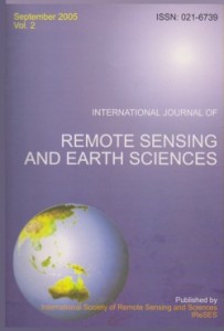
 Nuarsa I Wayan, Susumu Kanno, Yasuhiro Sugimori, and Fumihiko Nishio. 2005. Spectral Characterization of Rice Field Using Multi-Temporal Landsat ETM+ Data. International Journal of Remote Sensing and Earth Science, (2):65-71.
 Nuarsa I Wayan, Sandi Adnyana I Wayan, Yasuhiro Sugimori, Susumu Kanno, and Fumihiko Nishio. 2005. Development of the New Algoritm for Mangrove Classification. International Journal of Remote Sensing and Earth Science, (2):57-64.
 Gede Hendarawan, I Wayan Nuarsa, I Wayan Sandi, A.F. Koropitan, and Yasuhiro Sugimori. 2005. Numerical Calculation for the Residual Tidal Current in Benoa Bay-Bali Island. International Journal of Remote Sensing and Earth Science, (2):86-93.
 Takahiro Osawa, ChangFang Zhao, I Wayan Nuarsa, Swardika I Ketut, and Yasuhiro Sugimori. 2005. Vertical Distribution of Chlorophyll on Neural Netwaork. International Journal of Remote Sensing and Earth Science, (2):1-10.
 Takahiro Osawa, ChangFang Zhao, I Wayan Nuarsa, Swardika I Ketut, and Yasuhiro Sugimori. 2005. Study of Ocean Primary Produstivity Using Ocean Color Data Around Japan. International Journal of Remote Sensing and Earth Science, (2):12-18.
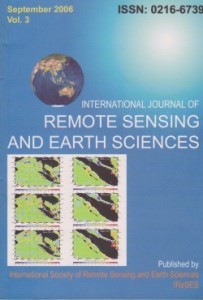 Susumo Kanno, Yasuo Furushima, I Wayan Nuarsa, and I Gede Henrawan. 2006. A New Approch for the Tsunami Prediction Using Satellite Altimtry: Trials for Aceh Tsunami Events in 2004 and 2005. International Journal of Remote Sensing and Earth Science, (3):31-40.
 Susumo Kanno, Yasuo Furushima, I Wayan Nuarsa, I Ketut Swardika, and Atsushi Ono. 2006. Estimation of Tuna Fishing Ground In Low Latitude Region Using Sea Surface Height Gradient Derived From Satellite Altimetry: Application to Northeastern Indian Ocean. International Journal of Remote Sensing and Earth Science, (3):59-79.
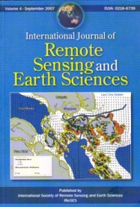 I Wayan Nuarsa and Fumihiko Nishio. 2007. Relationships Between Rice Growth Parameters and Remote Sensing Data. International Journal of Remote Sensing and Earth Sciences, (4):102-112.
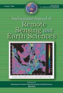 I Wayan Nuarsa, Fumihiko Nishio, and Chiharu Hongo. 2010. Modification of Input Images for Improving the Accuracy of Rice Field Classification Using MODIS Data. International Journal of Remote Sensing and Earth Sciences, (7):36-52.
 I Wayan Nuarsa, Fumihiko Nishio, and Chiharu Hongo. 2011. Spectral Characteristics and Mapping of Rice Plants Using Multi-Temporal Landsat Data. Journal of Agricultural Science. 3(1): 54-67.
 I Wayan Nuarsa, Fumihiko Nishio, and Chiharu Hongo. 2011. Relationship between Rice Spectral and Rice Yield Using Modis Data. Journal of Agricultural Science. Vol 3(2): 80-88.
 I Wayan Nuarsa, Fumihiko Nishio, and Chiharu Hongo. 2011. Spectral Characteristic Comparison of Rice Plants under Healthy and Water-Deficient Condition Using Landsat ETM+ Data. Journal of The Japan Society of Photogrammetry and Remote Sensing. 50(2): 66-79.
 I Wayan Nuarsa, Fumihiko Nishio, and Chiharu Hongo. 2012. Rice Yield Estimation Using Landsat ETM+ Data and Field Observation. Journal of Agricultural Science, 4 (3):45-56.
 I Wayan Nuarsa, Fumihiko Nishio, Chiharu Hongo, and I Gede Mahardika. 2012. Using variance analysis of multitemporal MODIS images for rice field mapping in Bali Province, Indonesia. International Journal of Remote Sensing. 33(17):5402-5417.
 Ida Ayu Gde Kurnia Jayanti, Takahiro Osawa, I. Wayan Sandi Adnyana, Tasuku Tanaka, I. Wayan Nuarsa, Abd Rahman As-syakur. 2012. Multitemporal MODIS Data to Mapping Rice Field Distribution in Bali Province of Indonesia Based on the Temporal Dynamic Characteristics of the Rice Plant. Earth Science Research, 1(1):64-74.
 Abd. Rahman As-syakur, I Wayan Sandi Adnyana, I Wayan Arthana, and I Wayan Nuarsa. 2012. Enhanced Built-Up and Bareness Index (EBBI) for Mapping Built-Up and Bare Land in an Urban Area . Remote Sens, 4(10):2957-2970.
 Abd. Rahman As-syakur, I Wayan Sandi Adnyana, Made Sudiana Mahendra, I Wayan Arthana,d I Nyoman Merit, I Wayan Kasa, Ni Wayan Ekayanti, I Wayan Nuarsa, and I Nyoman Sunarta. 2014. Observation of Spatial Patterns on the Rainfall Response to ENSO and IOD over Indonesia Using TRMM Multisatellite Precipitation Analysis (TMPA). International Jounral of Climatology. DOI: 10.1002/joc.3939.
 Abd. Rahman As-syakur, Takahiro Osawa, Fusanori Miura, I Wayan Nuarsa, Wayan Ekayanti, I Gusti Bagus Sila Dharma, I Wayan Sandi Adnyana, I Wayan Arthana, Tasuku Tanaka. 2016. Maritime Continent rainfall variability during the TRMM Era – The Role of Monsoon, Topography and El Nino Modoki. Dynamics of Atmospheres and Oceans, 75(1):58:77.
 Kuncoro Teguh Setiawan, Syifa Wismayati Adawiah, Takahiro Osawa, I Wayan Nuarsa. 2014. Application of Van Hengel and Spitzer Algorithm for Information on Bathymetry Extraction Using Landsat Data. International Journal of Environment and Geosciences, 1(1):73-80.
 Nguyen Tuyet Lan, Takahiro Osawa, I Wayan Nuarsa. 2017. Land Cover Change Detection Using Landsat Data in Giao Thuy District, Nam Dinh Province, Vietnam. International Journal of Environment and Geosciences, 1(1):22-27.
 Nuarsa, I Wayan, Abd. Rahman As-syakur, I Gusti Alit Gunadi, I Made Sukewijaya. 2018. Changes in Gross Primary Production (GPP) over the Past Two Decades Due to Land Use Conversion in a Tourism City. International Journal of Geo-Information,7(2):1-20.
 Nuarsa, I Wayan, I Nyoman Dibia, Ketut Wikantika, Deni Suwardhi, I Nyoman Rai. 2018. GIS Based Analysis of Agroclimate Land Suitability for Banana Plants in Bali Province, Indonesia. Hayati Journal of Biosciences, 25(1):11-17.
 Agung Budi Harto, Prila Ayu Dwi Prastiwi, Farah Nafisa Ariadji, Deni Suwardhi, Fenny M. Dwivany, I Wayan Nuarsa, Ketut Wikantika. 2019. Identification of Banana Plants from Unmanned Aerial Vehicles (UAV) Photos Using Object Based Image Analysis (OBIA) Method (A Case Study in Sayang Village, Jatinangor District, West Java). Hayati Journal of Biosciences, 26(1):7-14.
 Mega, I Made, I Wayan Nuarsa. 2019. Effect of Fungal Inoculation to Resin Content on Gaharu Plants (Gyrinops versteegii (Gilg.) Domke). International Journal of Environment and Geosciences, 3(1):20-16.
 Agit Setiyoko, Takahiro Osawa, I Wayan Nuarsa. 2019. Evaluation of GSMaP Precipitation Estimates Over Indonesia. International Journal of Environment and Geosciences, 3(1):24-43.
 Romaldo Da Costa Ximenes, Takahiro Osawa, I Wayan Nuarsa. 2018. Mapping of Soil Fertility Using Landsat Data in Lautem District, Timor-Leste. International Journal of Environment and Geosciences, 2(1):44-54.
 Dian Novianto, Takahiro Ozawa, I Wayan Nuarsa. 2018. Study of Albacore Tuna (Thunnus alalunga) Abundance Using Regional Ocean Modeling System (ROMS) Data In Indian Ocean. International Journal of Environment and Geosciences, 2(2):76-88.
 Budiasa, I Wayan, I Gede Rai Maya Temaja, I Nyoman Gede Ustriyana, I Wayan Nuarsa, I Gusti Bagus Adi Wijaya. 2020. The Willingness of Farmers to Pay Insurance Premiums for Sustainable Rice Farming in Bali. Journal of ISSAAS, 26(1):63:72.
 Abd. Rahman As-syakur, Keiji Imaoka, Kakuji Ogawara, Manabu D. Yamanaka, Tasuku Tanaka, Yuji Kashino, Wayan Nuarsa, Takahiro Osawa. 2019. Analysis of Spatial and Seasonal Differences in the Diurnal Rainfall Cycle over Sumatera Revealed by 17-Year TRMM 3B42 Dataset. The Scientific Online Letters on the Atmosphere (SOLA), 15(1):216-221.
 Watiniasih, Ni Luh, I Wayan Nuarsa, Made Merdana, Agus Dharma, I Nyoman Gde Antara, I Nyoman Budiarsa. 2021. Carbon Storage on Different Species of Seagrass on Tourist Destination Areas A Measure of Disturbed and Undisturbed Environments. International Journal on Advanced Science, Engineering and Information Technology-IJASEIT, 11(3):1224-1231.
 Watiniasih, Ni Luh, I Gede Hendrawan, I Wayan Nuarsa, Putu Angga Wiradana. 2023. Investigation of Microplastic Contamination in Sediments, Water and Aquatic Biota in Lake Beratan, Tabanan Regency, Bali Province – Indonesia. Journal of Ecological Engineering, 24(3), 323–332.